department of Planning, industry & environment
 |
NSW Urban Heat Island to Modified Mesh Block 2016
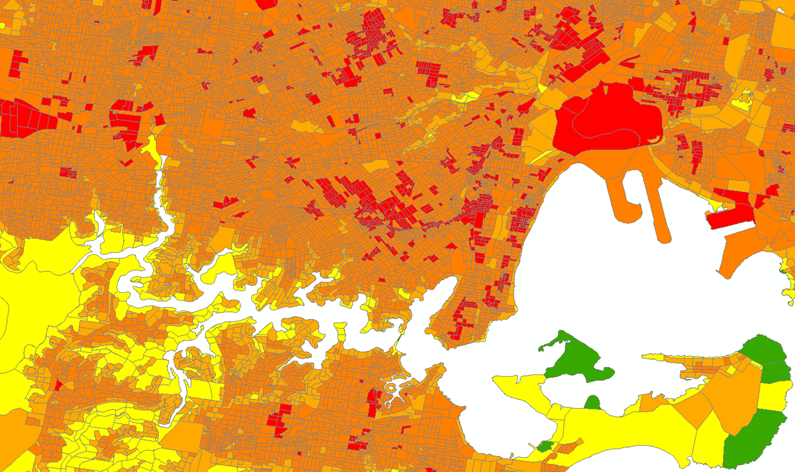
The dataset provides a measure of the effects of urbanisation on land surface temperatures across the Sydney Greater Metropolitan Area. An urban heat island (UHI) is a microclimate in an urban area where the average air temperature is substantially higher than surrounding non-urban areas. UHI is used to show the magnitude of deviation in surface temperature from that of a non-urban vegetated reference area, such as heavily wooded areas of national parks around Sydney.
UHI is a measure of the temperature increase that can be attributed to urbanisation. It is the difference between the actual temperature at an urban location and what the temperature would have been if that location had not been urbanised. Information on the location of heat islands can be used to plan mitigation actions that target their effects (e.g. increasing urban greening). The dataset provides an average UHI temperature, enabling multi-scale spatial analysis of the relationship of heat to green cover.
The dataset is relevant for the Significant Urban Area (SUA), a classification used by the Australian Bureau of Statistics (ABS), of the Sydney Greater Metropolitan Area (GMA), which covers urban, major urban, peri-urban and other urban areas. It does not provide complete coverage of the full extent of Greater Sydney Region, particularly the non-urban areas of large outlying LGAs such as Hawkesbury, Wollondilly and Blue Mountains. Parts of the Illawarra, Central Coast and Lower Hunter regions are also outside of the spatial extent of data coverage.
The dataset was derived from the analysis of land surface temperature (LST) data from Landsat 8 satellite imagery and the thermal and infrared bands with a 30m resolution. The dataset was combined with the Australian Bureau of Statistics (ABS) Mesh Block polygon dataset to provide a mean UHI temperature for the summer of 2015-2016. Mesh Blocks are the smallest geographical area defined by the ABS.
|
Field name(s) |
Description of attribute value |
|
|
ABS Mesh Block land zone category
|
MB_CAT16 |
The designated land zone types: Commercial Education Hospital/Medical Industrial Other Parkland Primary Production Residential Transport Water |
|
Urban Heat Island temperature |
UHI_16_m
|
Mean UHI temperature difference to non-urban vegetated reference land surface temperature (in Celsius)
|
This dataset and the relevant metadata are publicly available on the NSW SEED data portal.
For questions about the dataset, contact the Department of Planning, Industry and Environment
data.broker@environment.nsw.gov.au or 131555
.